


The Levant circuit in Porquerolles
The Le Levant circuit takes you east to the island of Porquerolles, where you'll encounter some of the wildest landscapes.
Station 1: Pointe Béarlieu
Follow the landing stage to the outer harbor cove. Behind the shops, on the right, a ramp leads up to Pointe Béarlieu. The climb is steep, but short. The path descends to the east and leads to the Courtade crossroads, which marks the boundary between the village and the plain of the same name. The path now runs under the pines, just after the fork that leads to Mont dessalins, just before the bridge, take the first path to the Courtade beach.
Station 2: Courtade Canyon and beach
Rejoin the track. On the right at the Pin de Charles clearing, tradition has it that the bride and groom jump over the white stone marker on the embankment to the right, to live happily ever after. The pine has long since disappeared, but the tradition lives on. After the Lequin fork, a sign on the left indicates the fort de l'Alycastre.
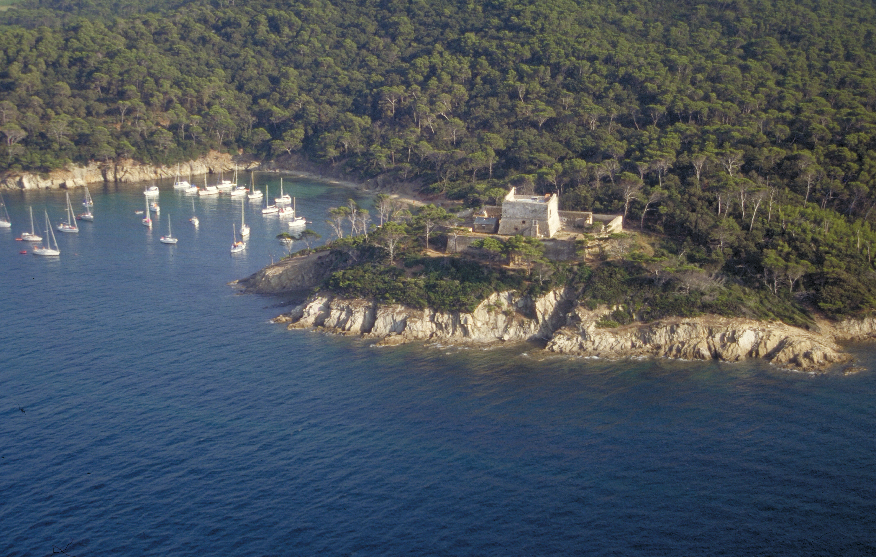
Station 3: Fort de l'Alycastre
The eight-pointed star-shaped architecture of the Fort de l'Alycastre is not out of place here, as it is essentially built from locally sourced materials: the crushed pebbles used for the rendering and the pieces of quartz that protect the chiste walls come from the beaches. This curious sand castle, built in the 17th century, is hardly visible from the sea. To resist cannonballs, the northern walls are almost four metres thick.return to the main track and turn left towards Notre Dame beach.
Station 4: Notre Dame lookout
Retrace your steps to the Notre Dame plain. At the edge of the forest and farmland, turn right: along the way, a few cork oaks, rare on the island, bear witness to a bygone era of cork production. The edge of the track has been cleared to limit the spread of any fire. Here and there, you can see the spindly bushes of flax-leaf broom, which blossom yellow in spring. This
Porquerolles boasts one of France's finest populations of this species. From here, you can go directly to Fort de la Repentance on the right, or make a detour to Anse de la Galère, before rejoining the fort. Beware: the Galère path is long and difficult, as it penetrates the most remote parts of the island. Don't overestimate your strength and allow at least another three-quarters of an hour.
Station 5: L'anse de la Galère
Once you've reached Anse de la Galère, a splendid view rewards the effort. In the foreground, the islets of Grand and Petit Sarranier. To the east, Port-Cros, the forest island, is finally revealed. To reach Fort de la Repentance, return to the crossroads of the plain. This will take you up a steep hill leading to the Col de la Repentance. Continue to the right, uphill past the small drystone structure. A milestone on the right-hand side of the track, about 100 m from the pass, serves as an observation point. Park your bike about 50 m ahead.
Station 6: Fort de la Repentance
From the crest, the view is a 360° panorama: Porquerolles in its entirety, with the succession of five high, forest-covered ranges, separated by four plains devoted to agriculture.retrace your steps to the small dry-stone village, then take the slope towards La Courtade. This leads to a tarmac road. Immediately afterwards, turn left and go around the fallow fields and then the vineyards, at the edge of the forest. Take the second path on the left, go down to the junction at the edge of the vineyards. Leave your bikes behind and follow the path to the left, towards the Oustaou de Diou cove.
Station 7: Calanque de l'Oustaou de Diou
Like a breach in the south coast, the calanque opens onto the deep waters of the open sea. Oustaou de Diou means "house of God" and recalls the existence of an ancient chapel on this spot. Get back on your bikes and ride along the vineyard to the fork in the road that leads up a shady slope to the crossroads of the four paths. Cross the crossroads and continue across the road to Fort Sainte-Agathe.
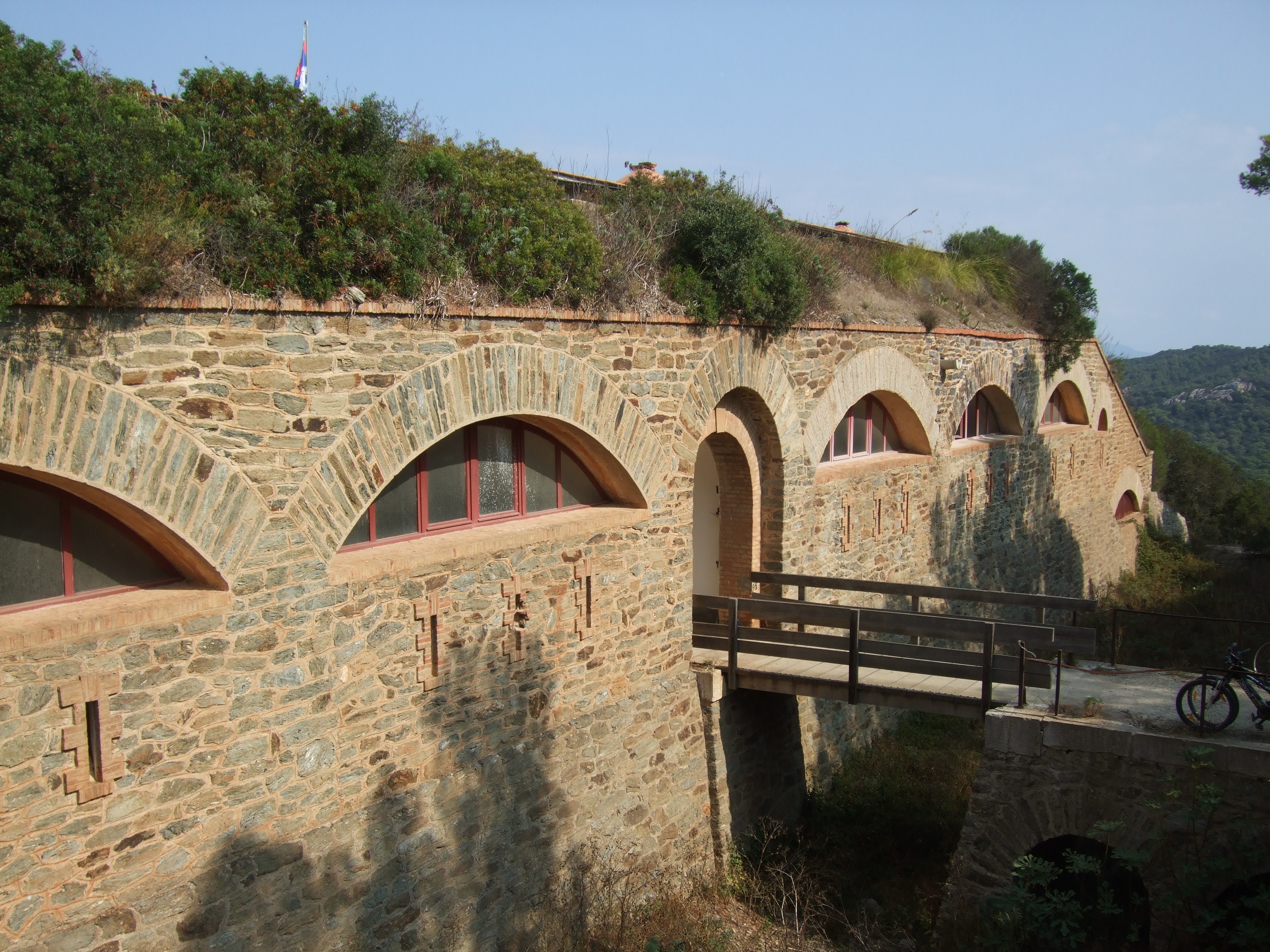
Station 8: Fort Sainte-Agathe
Around 1530, François 1er commissioned the construction of Fort Sainte-Agathe to protect the islanders. Classified as a historic monument, the fort Sainte-Agathe, which has been handed over to the Parc national de Port-Cros, is now home to an exhibition: the loopholes at the top of the tower and in the surrounding walls offer a view of a landscape that is now peaceful. Its careful observation, between the Courtade plain and the village plain, sheds light on the principles of Porquerolles' development.
Photo gallery
Prices
Free of charge.
-
Display phone number
-
Write to the owner